Features MasterSailor
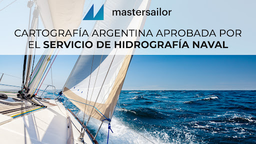
MasterSailor is the only Navigation App with Cartography approved by the Naval Hydrographic Service.
With MasterSailor you will have all the technology for navigation in a single application.
Up-to-date cartography, GPS, current and forecast weather, tides and depths in real time, sailing directions, communication functions for emergencies and much more...-Digital CartographyOwn, approved and updated vector charts and all GPS functions available.
Graphic interface with multiple information on screen.
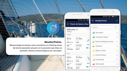
Possibility of sharing waypoints and routes with other users with a simple click.-Preloaded sailing directionsIt includes more than 20 Sailing Directions so you can navigate from your position and to the port you want with total safety.-WeatherPointsReal-time weather and forecast in different areas of interest (current position or in the position you choose on the screen).
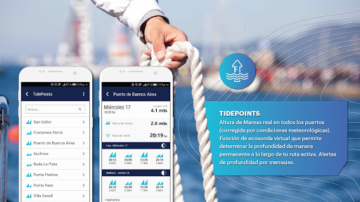
Weather alerts by messages.-TidePointsReal height of tides in all ports (corrected for weather conditions).
Virtual echosounder function that allows you to determine the depth permanently along your active route.
Depth alerts by messages.-Emergency, Urgency and Alerts call systemPossibility of sending a distress call to the Naval Prefecture or alerting other sailors in the area with a single click.
The messages will go viral on the screen of all MasterSailor users.-Services to the navigatorInformation on all types of Nautical Services: Nautical Clubs, Slipways, Naval Warehouses, Nurseries, and much more.
Music Features
Enjoy high-quality music streaming and playback features.
Weather Features
Get accurate weather forecasts and real-time updates.
Fitness Tracking
Track your workouts and monitor your health metrics.
See the MasterSailor in Action
Get the App Today
Available for Android 8.0 and above